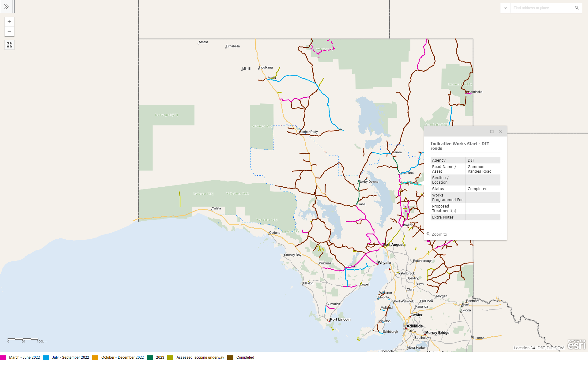
Flood Recovery Response Map
Extensive flooding in the north of South Australia in Q1 2022 caused road closures and damaged DIT assets. DIT initiated the flood response which consisted of some immediate emergency works to enable movement on the network and also a plan of future remediation works to take place over 12 to 24 months. Mapping and management of spatial information to help undertake these tasks was required. A Flood Recovery Map was determined to be a suitable way to inform the public of the scheduled works on damaged parts of the network.
For more information see the Flood Recovery Response site.