Service catalogue
We offer a variety of services that deliver ongoing insights to teams in our department to empower them to make data-driven decisions.
Our services and products:
- provide advice, solve problems and assess business needs
- deliver business-approved analytics solutions
- develop strategic and tactical transport insights
- create data visualisations, GIS products and dashboards
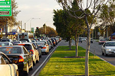
- source traffic data and insights to understand our network
- collect road asset data to inform asset management insights.
Make a service request
If you need more information, support from our team, or access to our services or products, please engage our services.
Our portfolio
filters
-
 TA Mapping Request
Submit a request for GIS mapping work
-
 Aerial Imagery Request
Submit a request for an aerial imagery clip
-
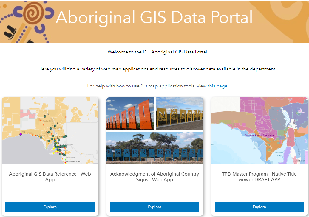 Aboriginal GIS Data Portal
A variety of map applications and resources to discover data available in the Department. Including Aboriginal GIS Data Reference, Acknowledgment of Aboriginal Country Signs and TPD Master Program - Native Title Viewer.
Access requirements apply. -
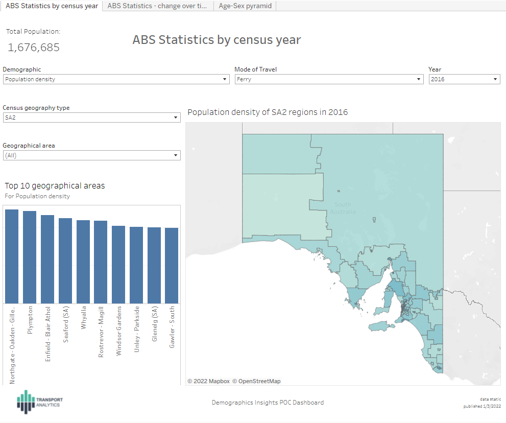 ABS Population and Household Demographics
Demographic information for Census years, differences between Census years and area age-gender distributions. .
-
 Asset Insights
Visualisation of network-wide Asset Information providing valuable insights to make informed decisions. Interactive dashboards (graphical, tabular and spatial visuals) that can be downloaded either on a PDF page for presentation or Excel sheets for further analysis.
License and access requirements apply. -
 Cycling Strategy Interactive Map
An interactive online map for navigating existing and proposed cycling routes for the Cycling Strategy of South Australia 2022-2032
-
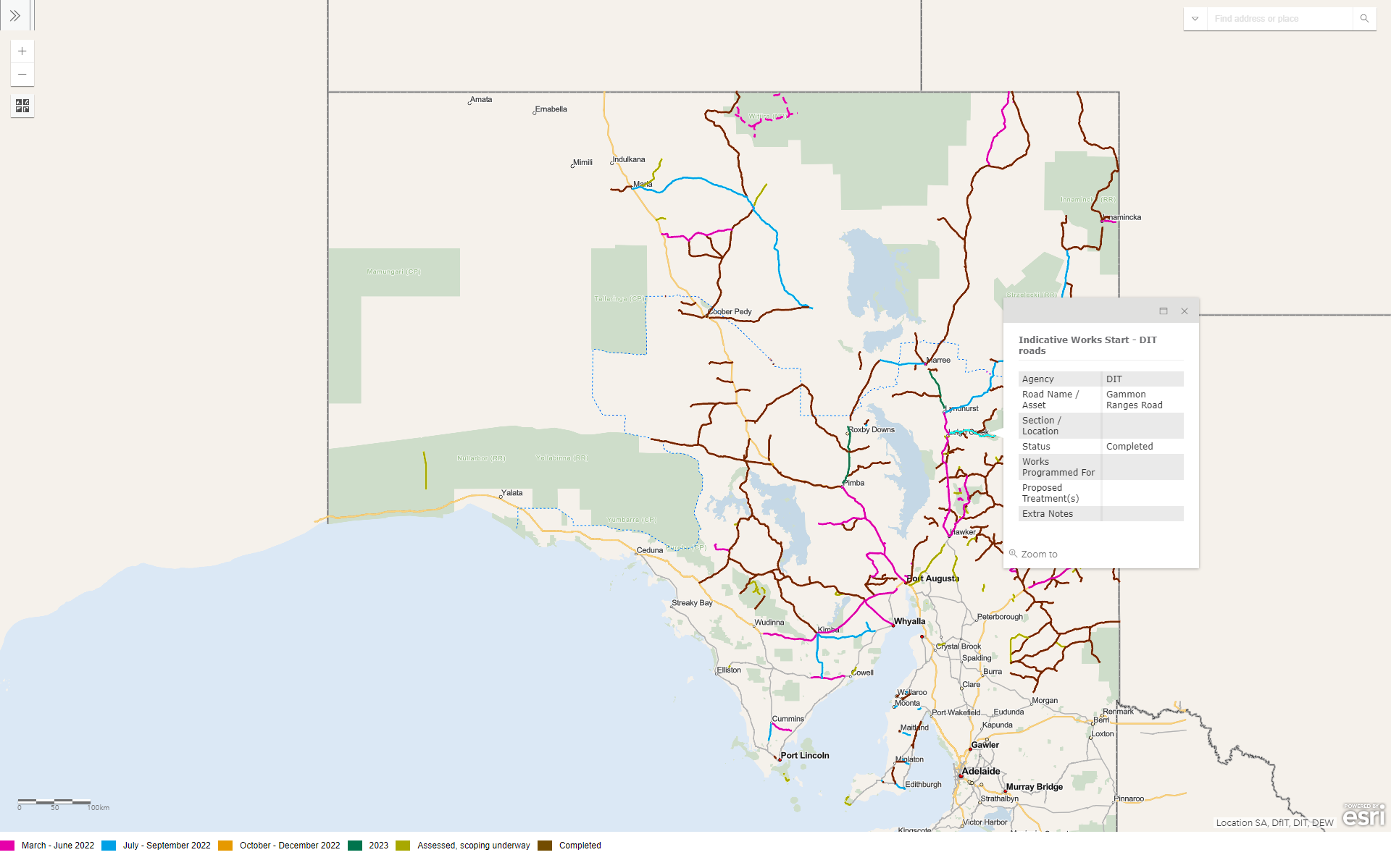 Flood Recovery Response Map
The works program in the map and list below outline the nature, location and indicative timing of these recovery works. The works program includes.
-
 Outback Flooding Web Map
Tools relating to the 2025 Outback Flooding event in the NE corner of SA.
-
 Outback Roads GIS Portal
Portal for web maps and resources to discover outback data available in the department.
Access requirements apply. -
 Outback Roads Map
An interactive map of Outback Roads showing key assets including bores, dams, pits, grids and culverts.
-
 Hawkeye Insight
Enables the visual assessment of collected sealed road network condition, geometry, and videography data, in a simple, user-friendly format and data export.
Licence and access requirements apply. -
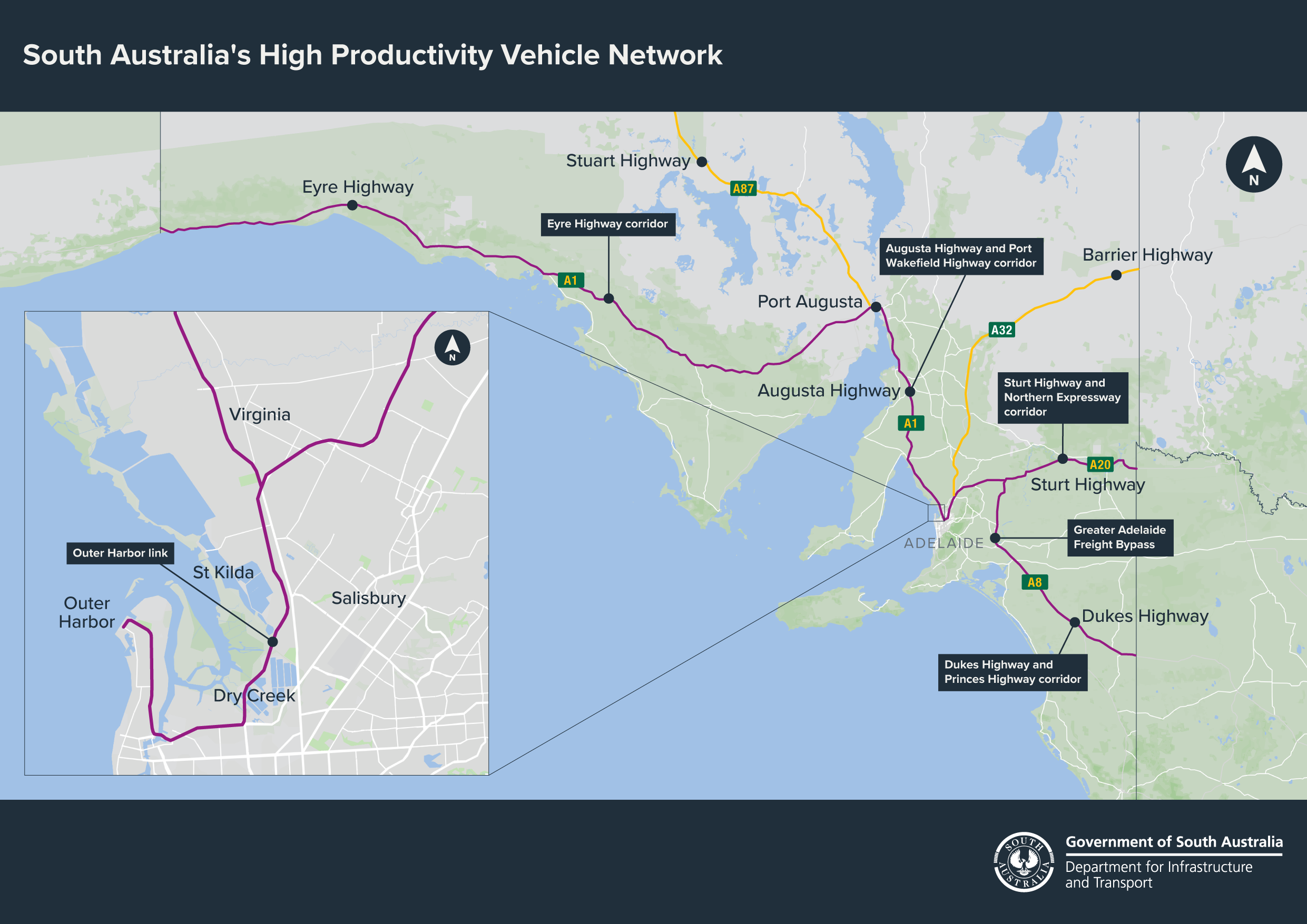 HPVN Map Portal
Web maps and resources for exploring outback data available within the department.
Coming soon -
 Marine Map
A map of marine structures on the South Australian state road network.
-
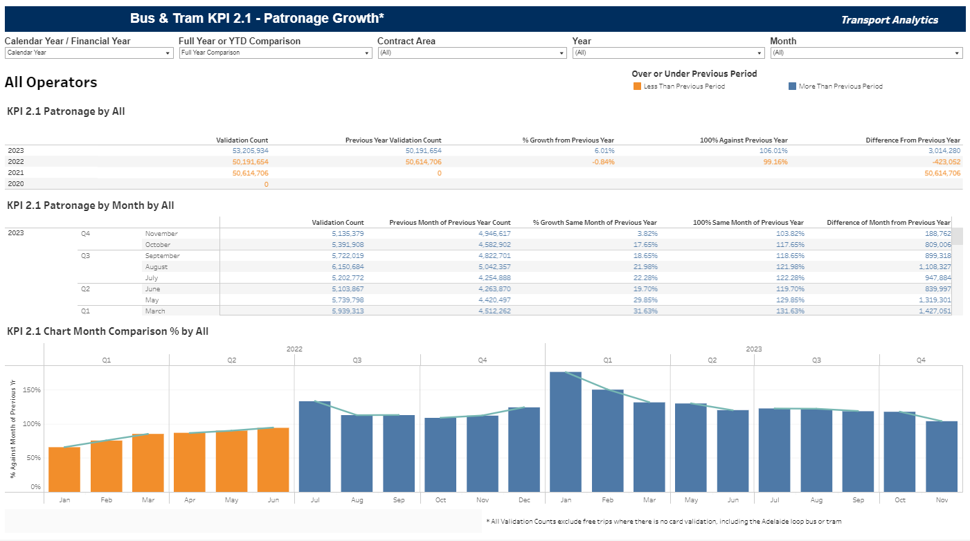 PT Bus & Tram KPIs
A suite of reports showing bus and tram monthly and quarterly performances of PTSA in relation to defined Bus KPIs
Licence and access requirements apply -
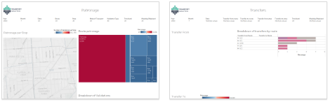 PT Customer Transfers
A collection of reports that allow the exploration of transfer validations. These transfer validations can indicate passengers need to change to different services as part of their journey. This provides insights into route change to better serve our passengers.
License requirements apply -
 PT Origin Destination Heatmap
Reports showing both popular inferred destination based on selected origin, and the most common inferred origin stops.
License requirements apply -
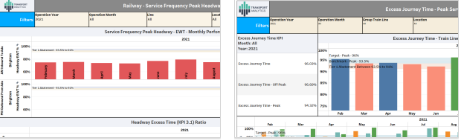 PT Railway Performance Reporting
A suite of reports showing railway performance across various KPIs such as Patronage Growth, Service Frequency Peak Headway, Excess Journey Times etc.
Licence and access requirements apply -
 Road Ancillary Assets Map
A map showing the location of road ancillary assets such as signs, fences, median strips and fire hydrants in the South Australian road network.
Post July 2025 data via Asset Vision only -
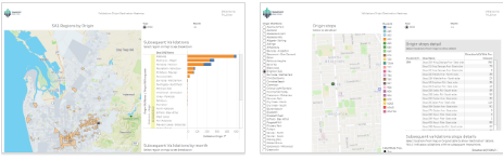
 Road Asset Information Map
A map showing information about roads, pavements, roundabouts and crossings in the South Australian road network.
-
 Road Lighting Assets Viewer
A map of road lighting assets maintained by the State and stored in the Register of Electrical and Intelligent Transport Systems (REITS).
Post July 2025 data via Asset Vision only -
Signs Map
A map of all road signs on the South Australian road network.
Post July 2025 data via Asset Vision only -
Structures Map
A map of road assets maintained by the Department.
-
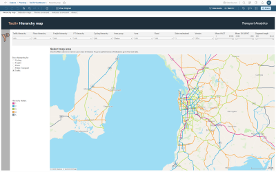 Tactiv
Network-wide, segment (movement and place) based indicators providing analysis of overall road network performance in terms of road safety, public transport, general traffic and freight, road asset condition, walking, tree canopy cover, and cycling.
License and access requirements apply. -
 Traffic Information Map Browser
Intractive map showing traffic surveys (turning movement, count and classification) and traffic estimates (sections, AADT and heavy vehicles) alongside roads and signals.
-
 Traffic Signals and ITS Web App
A map of traffic signals across the state, their locations and asset information.
Post July 2025 data via Asset Vision only -
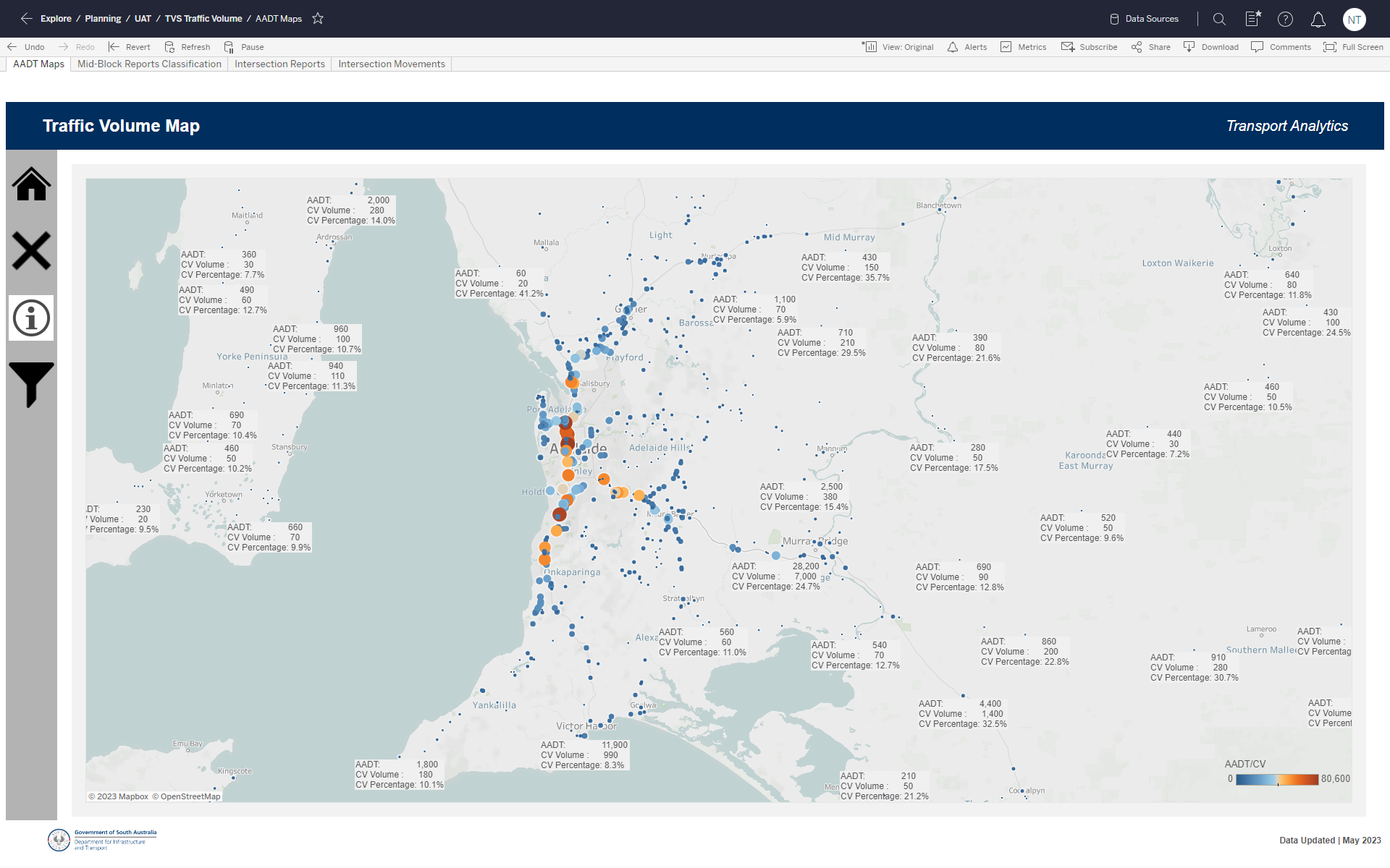 Traffic Volumes (TVS) Dashboard (in testing)
An interactive online map for exploring Traffic Volume Storage data. This includes traffic and commercial vehicle counts, vehicle classifications and intersection movements.
-
 Transport Performance System (TPS) Incident Reporting
Dashboard showing incients and resulting disruptions by various categories.
Licence and access requirements apply